A boundary adjustment (or lot line adjustment) is the movement of one or more lines between land parcels.
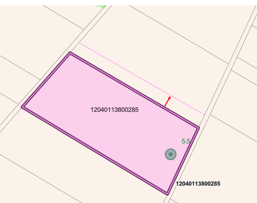
Boundary Adjustment Visualization
In VertiGIS FM Parcel, the you can document this type of adjustment using the boundary adjustment workflow, which changes the Area [m2] property of a land parcel in your database.
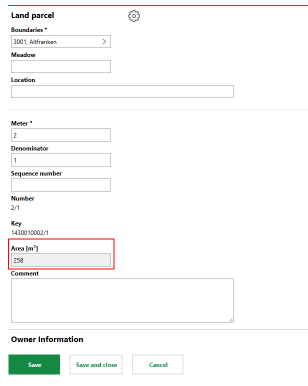
Land Parcel Area [m2] Field
If a land parcel does not have any existing change certificates associated with it, you can also change its Area [m2] property by editing the land parcel. If a change certificate has already been made effective for a land parcel, you can only edit its area by creating a boundary adjustment change certificate for it.
Adjust a Land Parcel's Boundary
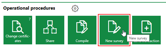
You can create a change certificate that documents a land parcel's boundary adjustment on the VertiGIS FM Parcel dashboard.
To Adjust a Land Parcel's Boundary
1.Navigate to the VertiGIS FM Parcel dashboard.
2.Under Operational Procedures, click New Survey.
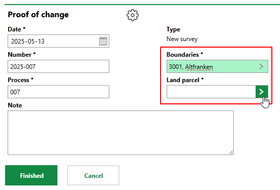
3.Enter the following inputs in the remaining mandatory fields:
▪Number: A number or code used to identify the change certificate internally.
▪Process: A string used to track the split outlined in the change certificate.
4.In the Cadastral Districts menu, click the arrow icon, and then double-click the district in which the land parcel whose boundaries you want to adjust is located.
5.In the Land Parcel menu, click the arrow icon, and then double-click the land parcel whose boundaries you want to adjust.
6.In the Newly Surveyed Area field, enter the updated area of the land parcel based on the boundary or lot line adjustment. Its current area is reflected in the Original area [m2] field.
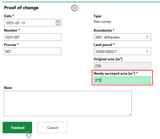
7.Click Finished.
The change certificates page now includes an entry for the boundary adjustment.
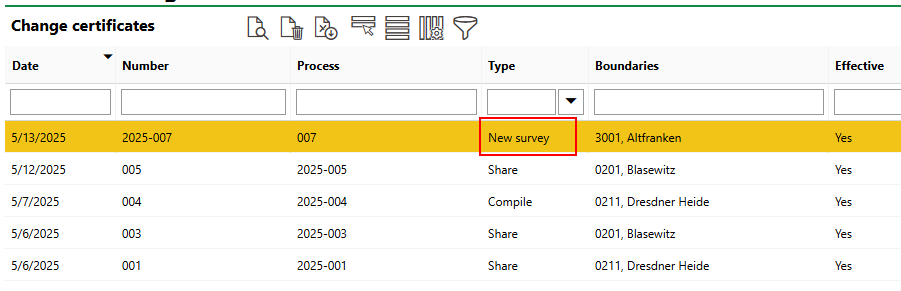
Boundary Adjustment Entry on Change Certificates Page
The details page for the adjusted VertiGIS FM now reflects its new area in the Area [m2] field and its previous area in the Original area [m2] field.
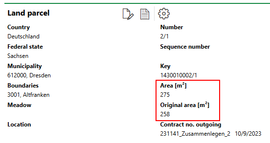
Updated and Previous Areas on Land Parcel Details Page