A district is a territorial unit within a municipality that is used to group land parcels in the cadastral hierarchy.
Each land parcel in VertiGIS FM Parcel must have the district in which it is located selected in its details.
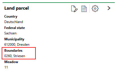
District Menu in Land Parcel Details
A district, or cadastral district, is not the same thing as a land register. A district and a land register refer to areas in different hierarchies used in land parcel management. Refer to Land Parcel Hierarchies for more information.
You can view and manage the districts in your database in either of two places in VertiGIS FM:
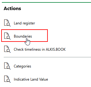
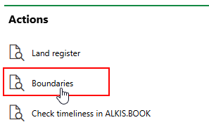
•On the VertiGIS FM Parcel dashboard (Actions > Cadastral Districts). This page provides a list of all cadastral districts in the system.
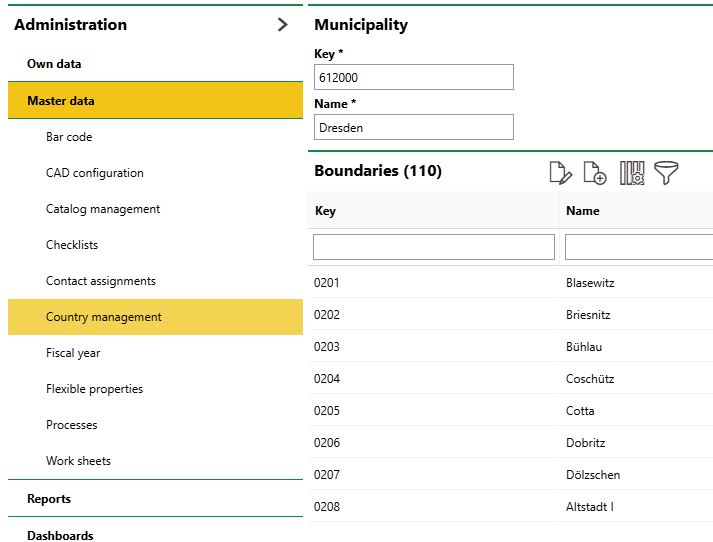
•In the country management administration (Administration > Master Data > Country Management). Double-click a state in the Federal States section, and then double-click a municipality in the Municipalities section. The cadastral districts within the municipality are listed.
Add a District
You can add a cadastral district to VertiGIS FM in the VertiGIS FM Parcel product and specify its municipality in the process, or add a district to a specific federal state in the country management administration.
To Add a District in VertiGIS FM Parcel
1.Navigate to the VertiGIS FM Parcel dashboard.
2.Under Actions, click Cadastral Districts.
3.Click the Add (![]() ) icon.
) icon.
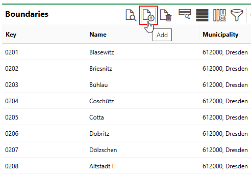
4.Enter a Key and Name for the district, and select the municipality in which it is located. Refer to District Details for field descriptions.
5.Click Save and Close.
To Add a District in the Country Management Administration
1.Navigate to the country management administration page (Administration > Master Data > Country Management).
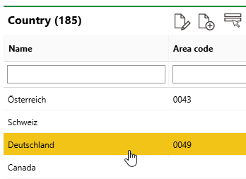
2.Double-click the country in which the municipality to which you want to add a district is located.
3.Double-click the federal state in which the municipality to which you want to add a district is located.
4.Double-click the municipality in which the district you are adding is located.
5.Expand the Municipalities section and click the Add (![]() ) icon.
) icon.
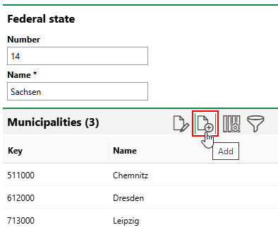
6.Enter a Key and a Name for the district. Refer to District Details for field descriptions.
7.Click Save and Close.
Field |
Description |
|---|---|
Key |
A unique identifier to organizations parcels within the district. |
Name |
The name of the district. |
Municipality |
The municipality in which the district is located. Selectable options are stored in the federal state's details page in the Country Management administration. This menu is only available if you add the district through VertiGIS FM Parcel. |
Standard Lane Value / m2 |
The value of land per m2 in the district. This menu is only available if you add the district through VertiGIS FM Parcel. |