The VertiGIS FM Parcel product is a suite of VertiGIS FM land management modules whose contents vary depending on your location. Typically, the solution comprises
•a module developed specifically for integration with the exportable data from your country or region's land registry bureau. The "official view" of your land registry data, this module allows users to upload newly released data files from a government registry but does not allow users to edit it. This module stores the data that was most recently made available by the jurisdiction's land registry office.
•the Land Parcels module, which contains the bulk of the parcel management and features. In this module, you can split, combine, adjust, and manage transactions for land parcels associated with your facilities. It acts as the "unofficial view" of your land parcels and can be updated with data uploaded into the land registry module developed for your country or region as data is released.
The name of the land registry module varies depending on your country or region's land registry office. If you do not know how to access it in the left pane, contact support.
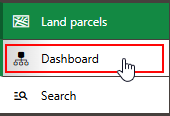
You can access the Land Parcels module by expanding Land Parcels in the left pane and clicking Dashboard.
Navigation to VertiGIS FM Land Parcels