VertiGIS FM Parcel groups land parcels using two separate hierarchies: the land registry hierarchy, for bureaucratic and administrative purposes, and the cadastral hierarchy, which assigns parcels a unique key based on their location and ownership history. Public authorities in most countries use these hierarchies in their land administration.
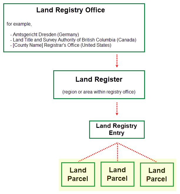
Land Registry Office Hierarchy
The land registry office hierarchy groups land parcels according to the land registry office under whose jurisdiction they fall. They are then sorted by land register (area within a land registry office's jurisdiction) and then by land registry entry, sheet, or folio (and administrative parent for land parcels).
Land Parcel Hierarchy in VertiGIS FM
The levels in the land registry hierarchy are defined using the following terms:
•land registry office: the office that manages parcel administration for a province, county, or municipality.
•land register: an area within the land registry office's jurisdiction.
•land registry entry: an administrative object for one or more parcels that can be managed together (for example, because they have the same owner).
•land parcel: an individual piece of land within legally defined boundaries.
Cadastral Hierarchy
The cadastral hierarchy groups land parcels according to their location and dimensions.
Each land parcel you add to the database must be associated with the cadastral district in which it is located. Each district is associated with a municipality stored in the Country Management administration section, under the parcel's federal state. You can enter a numerical value that corresponds to the parcel's section within the district in the land parcel's core details.
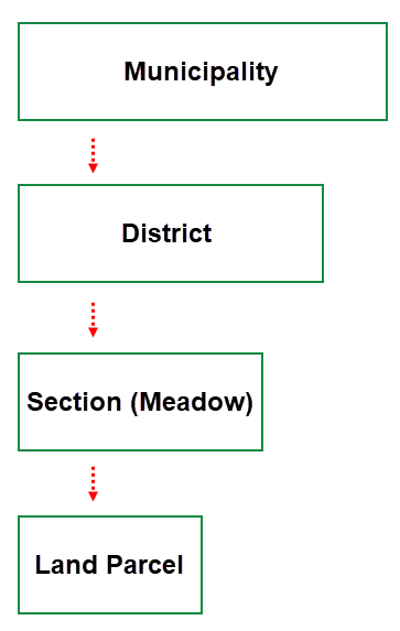
Cadastral Hierarchy