After you create a multiline, you can edit its course, the features it includes, and the gap between lines.
To edit multilines:
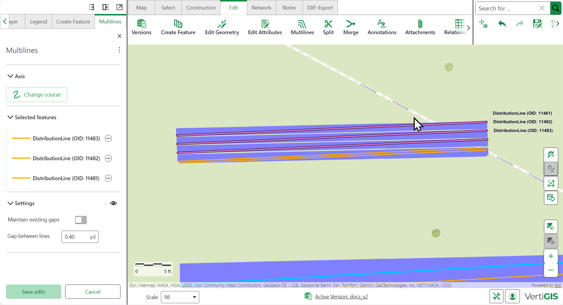
1.Go to Edit > Multilines. In the left side panel, the Multilines tab opens.
2.In the Edit section, click Define Section. The mouse pointer switches to edit mode and you can draw a section over the line features whose course is to be changed.
When editing a multiline feature, all connected net points and line vertices are moved to adapt with the new multiline segment geometry.
3.Optional: Click Configure tools form the action menu next to Multilines, to adjust the search buffer.
Click on the tool-tip next to Multiline edit to learn more about the search buffer setting.
4.Click Change Course to create a new axis in the area of the previously selected section.
You can choose which line is used as a reference line when repositioning an existing multiline.
5.In the Selected features section, features that are included in the defined section can be excluded from the change using the minus button.
The selected features are always represented in correct order and hierarchy.
6.In the Settings section:
oToggle Maintain existing gaps to disable the option to change gap between lines.
oInput a new value for Gap Between Lines. (works only if maintain existing gaps is disabled)
7.Click Save edits.
Extend multilines
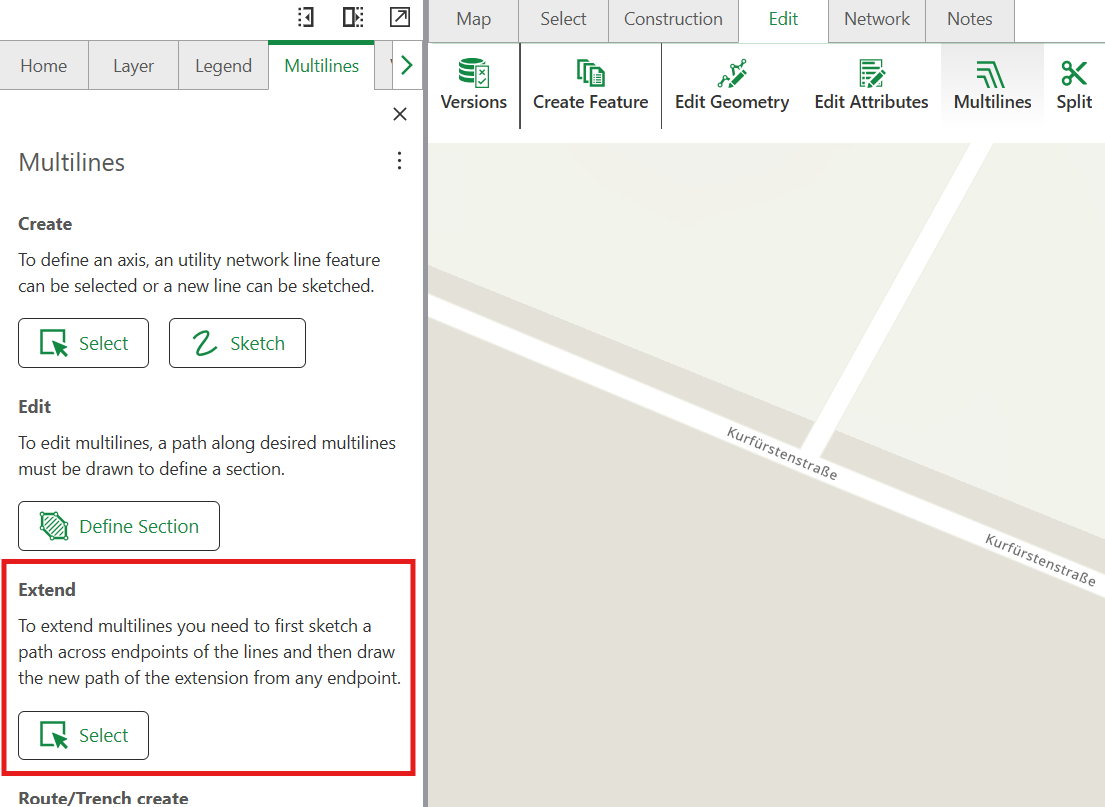
Extend the endpoints of an existing multiline to lengthen line features while maintaining their parallel relationship and spacing.
Extending a multiline merges the extension into the original feature, resulting in a single segment.
Prerequisites
•A multiline feature must exist in your project
•Endpoints to be extended must be on the same line
Extend a multiline
1.Select Edit > Multilines.
2.In the Extend section, select Extend Multilines.
3.Draw a line across the multiline endpoints that you want to extend.
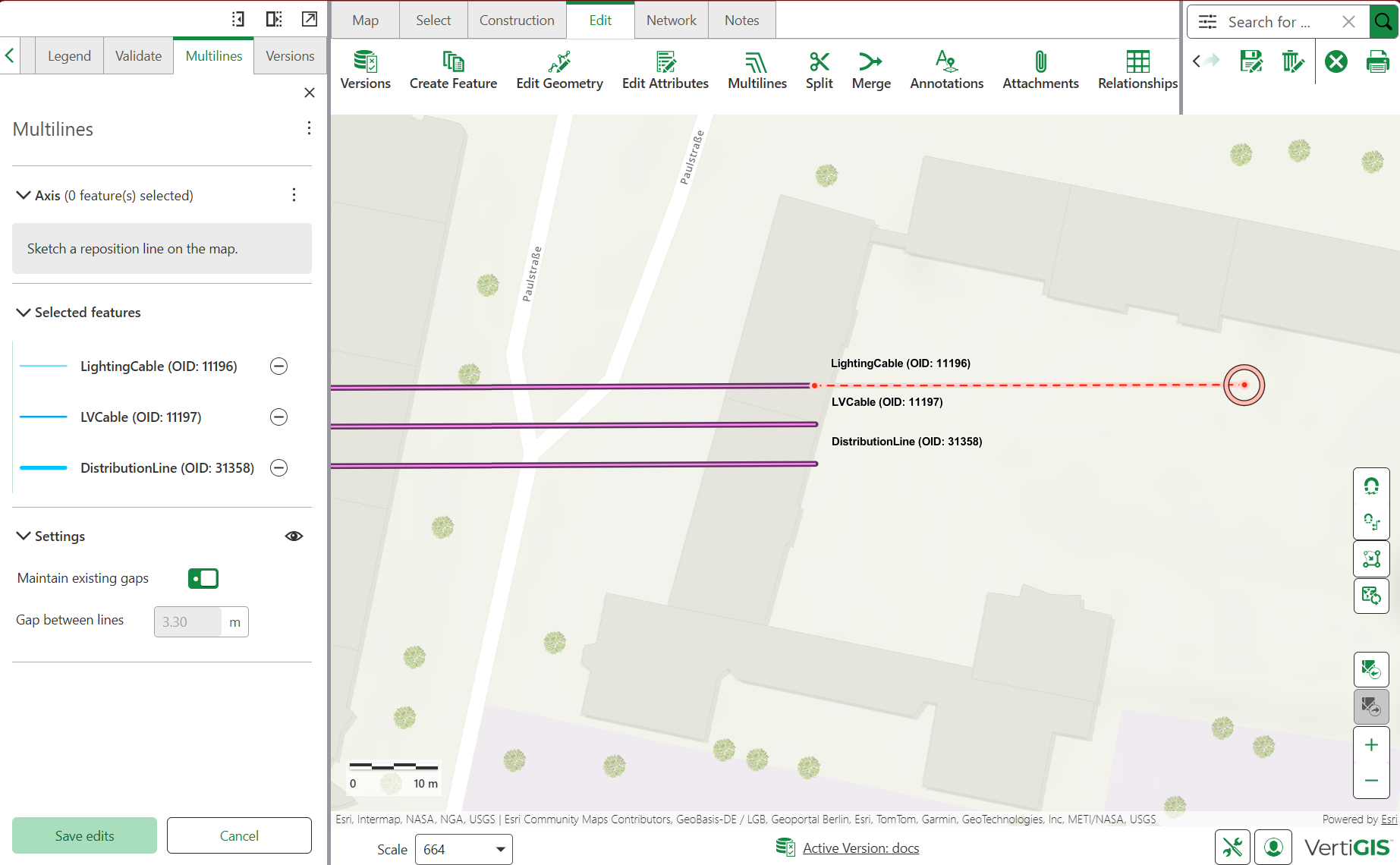
4.In the Axis section:
a)Select Extend Endpoints.
b)Sketch a reposition line on the map to define the extension path.
▪Start sketching from one of the selected endpoints.
▪Double-click the last point to finish drawing.
5.In the Selected features section, review the selected features. To exclude a feature from the extension, select the minus sign (-) next to the feature.
6.In the Settings section, configure the following parameters:
oMaintain existing gaps: disables the option to modify 'gap between lines'.
oGap between lines: The spacing between parallel lines
7.Review the preview of the extension.
8.Select Save edits to apply the changes.