The Summary window allows you to drill into the granular details of the locate request, add comments, add attachments, assign, review locate activity, and view the locate boundary.
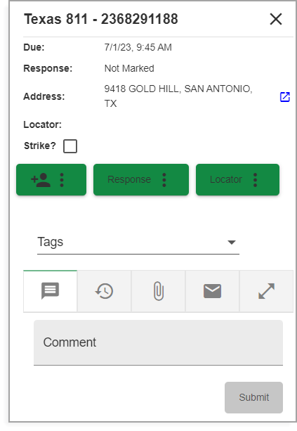
Summary window
The Summary window appears after left clicking a locate in the Locates Grid. This also automatically shows the locate boundary and zooms to the location. The locate request highlights within the Locates Grid until you select another locate request. A green boundary represents a user-selected locate request. The fill within the grid can be toggled off by selecting the Locate Boundary Fill icon positioned at the top right of the Locates Grid window.
![]()
Locate Boundary Fill icon
The Locate Boundary Fill allows you to activate commands within the locate boundary area. For example, the Measure Tool could be used to measure an easement or edge of pavement.
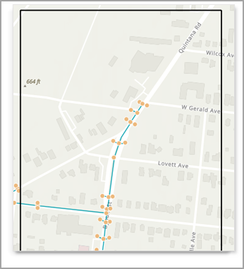
After toggling Locate Boundary Fill