To query a station from GIS:
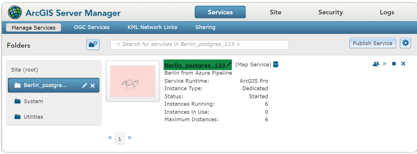
1. Open ArcGIS Server Manager.
2.From the Service tab>Manage Services>Berlin_postgres, open the Berlin demo data to edit it.
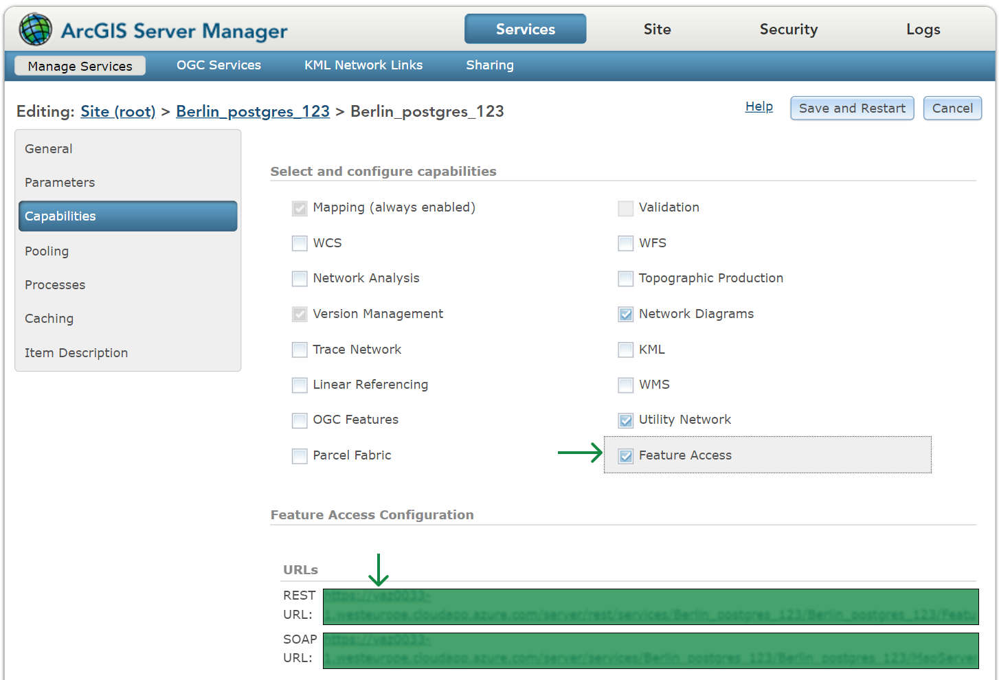
3.From the Capabilities entry, select Feature Access (will become highlighted upon selection).
4.From the URLs section, open feature service by clicking on the REST URL link.
5.From the Berlin_postgres (FeatureService) page, scroll down to the Layers section.
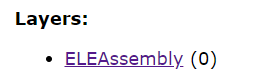
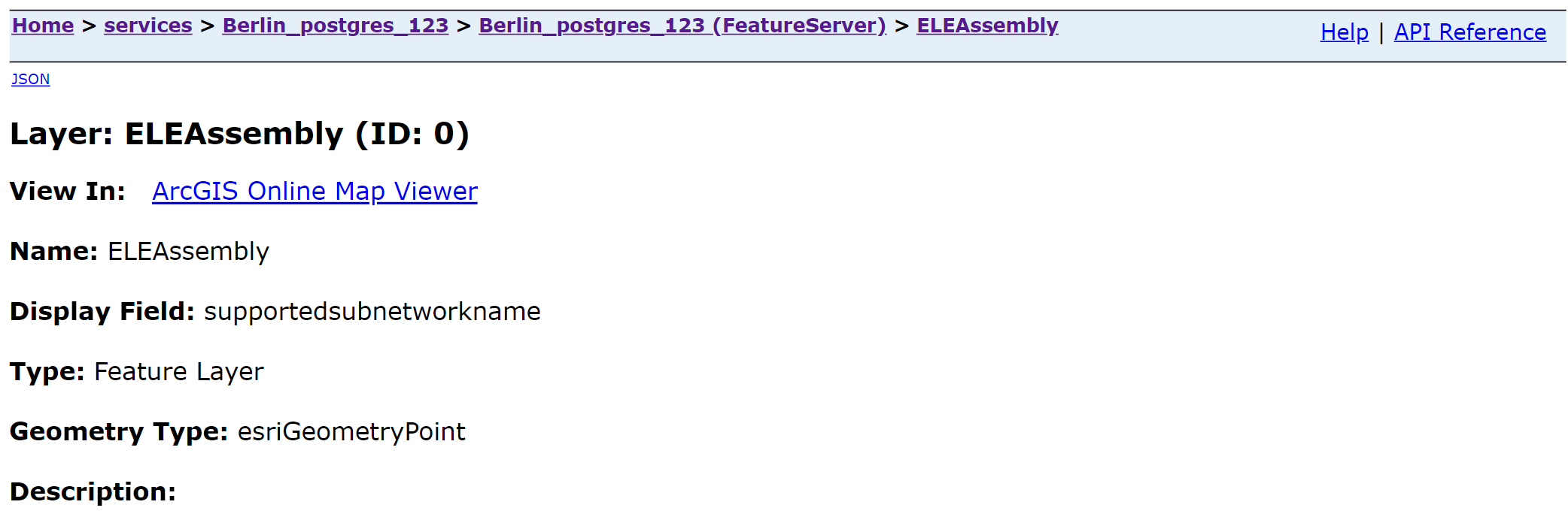
6.Click on the ELEAssembly (0) to see its content. The station is part of this electricity assembly, so it's the layer 0.
7.In the Types section you can see the IDs of the assetGroups (e.g. ‘ID: 200’), the name of the assetGroups (e.g. ‘StationAssembly’) and the assetTypes (e.g. ‘[202: Substation]’, etc.).
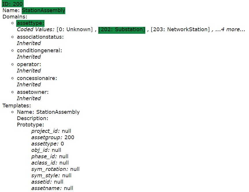
The assetGroups and assetTypes are predefined fields that define the object types at the end. Also, they are not unique for the complete data set but only for the layer itself (e.g. we can have ‘assetGroup = 200’ for various assemblies; but the combination between the layer, assetGroup and assetType is unique).
8.Scroll down until you reach the Supported Operations section, and click on the Query button.

Upon clicking on the Query button, you will land on the Query page.
Set the query parameters:
1.In the Where field, enter the assetGroup for the station assembly and assetype for the substation:
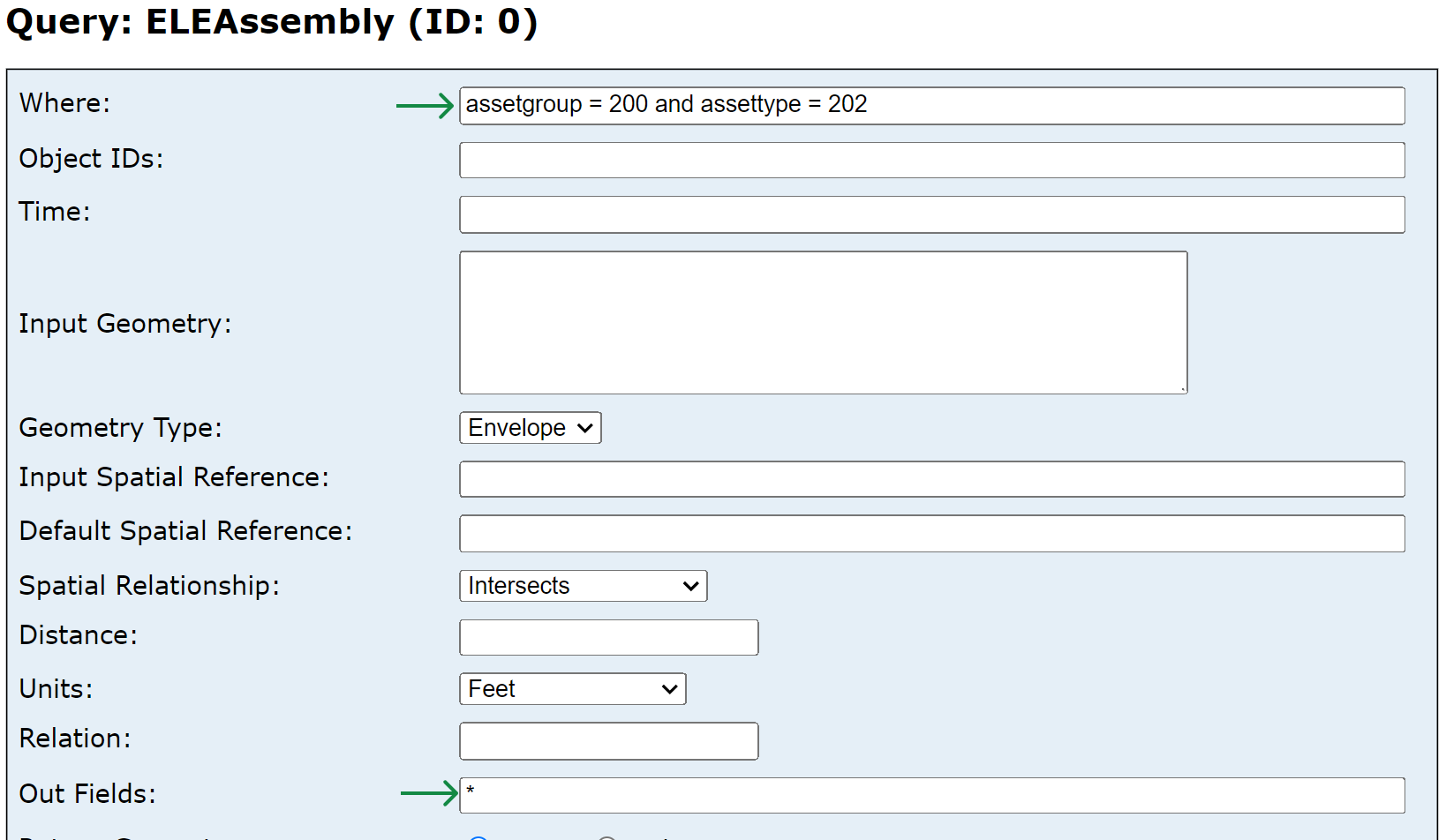
2.In the Out Fields, add a "*" wildcard. Adding a wildcard will display all the fields.
3.Form the Format drop down menu, select the output format type as JSON.
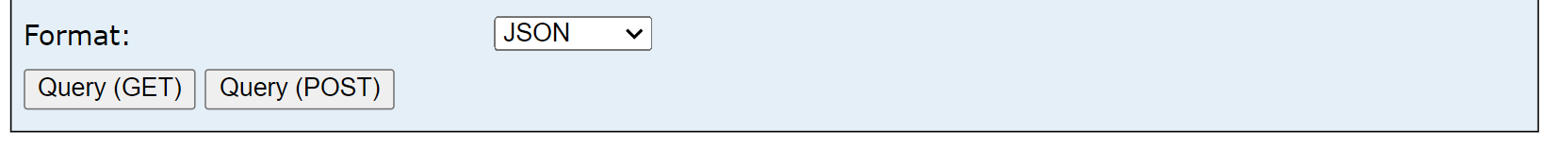
4. Click on the Query (GET) button to finish the process.
Upon clicking the Query (GET) button, a new page is opened where the metadata about the fields, features, attributes, and geometry is displayed. In the features section you can see all the matching assets. The station assemblies are the asset group 200 and asset type 202.
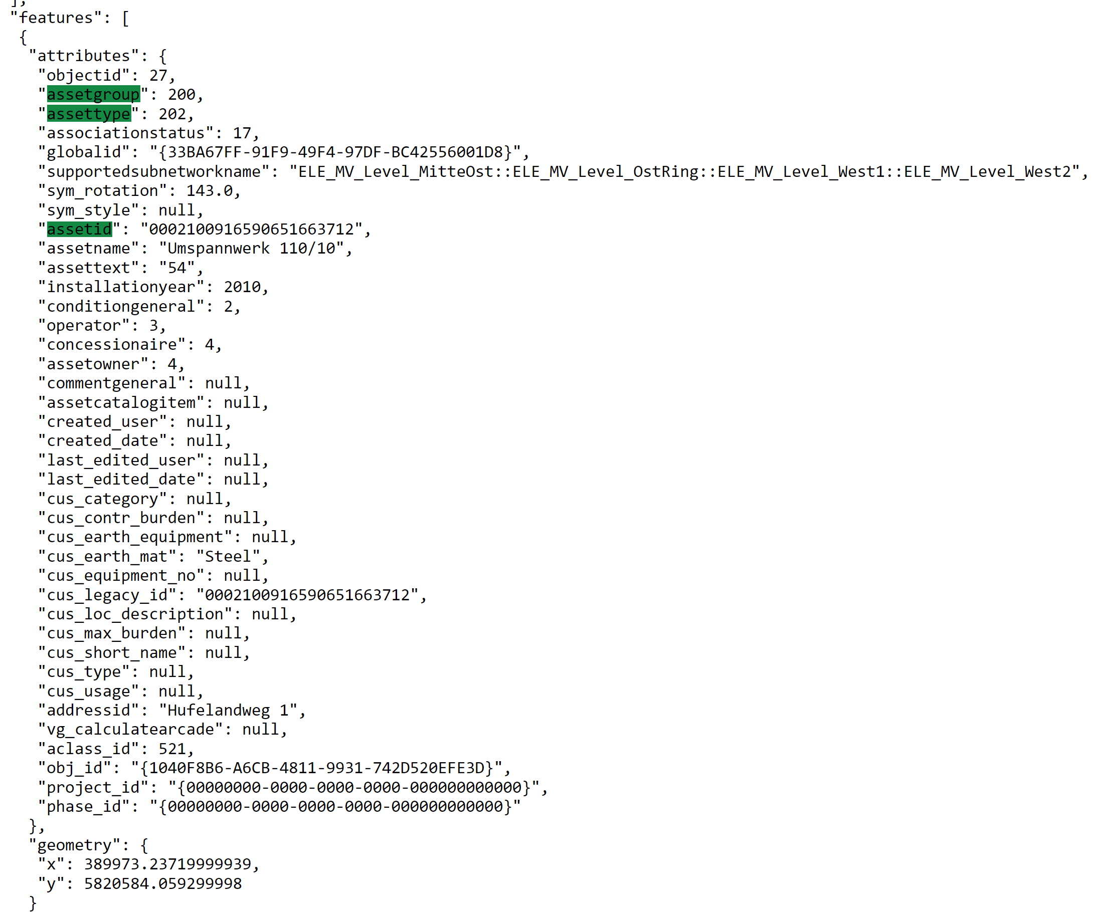
Some fields can be used for SAP integration, e.g. assetid, a field where the GIS can store an id from SAP.
When you start a new customer project with this Utility Network, you have to add a new field for the SAP id, which would be called ‘functional location id’ or ‘equipment number’, but in the Berlin demo data, the ‘assetid’ is used instead.