System Overview
DXF Export enables users to export geospatial data from Esri feature service layers into DXF and Binary DXF format while maintaining the map's symbology.
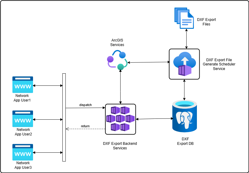
Network Editor App User
The user initiates a DXF export from the application UI, triggering the poll service which monitors the status (In progress / Completed / Failed) of the export service request.
Export logs provide access to all export history.
DXF Export Backend Services
DXF export backend services communicate with the database and Esri feature services to process the request data and return the response.
DXF Export Scheduler Service
The DXF export scheduler service operates independently to access geometries and symbols from layers specified by a web map linked to one or more feature services. It then converts the map geometries into DXF format and stores the resulting DXF files on the server for download.