By default, an Open Street Map (OSM) is available for all customers. Customers that do not have any GIS projects can use this map to show the locations of assets and tasks in VertiGIS FM.
Objects' locations are shown according to the location information stored directly in the database. Assets like real estates and buildings are shown according to their own street address, and devices are shown using the addresses of the VertiGIS FM Buildings assets selected in the Locations section on the device details page.
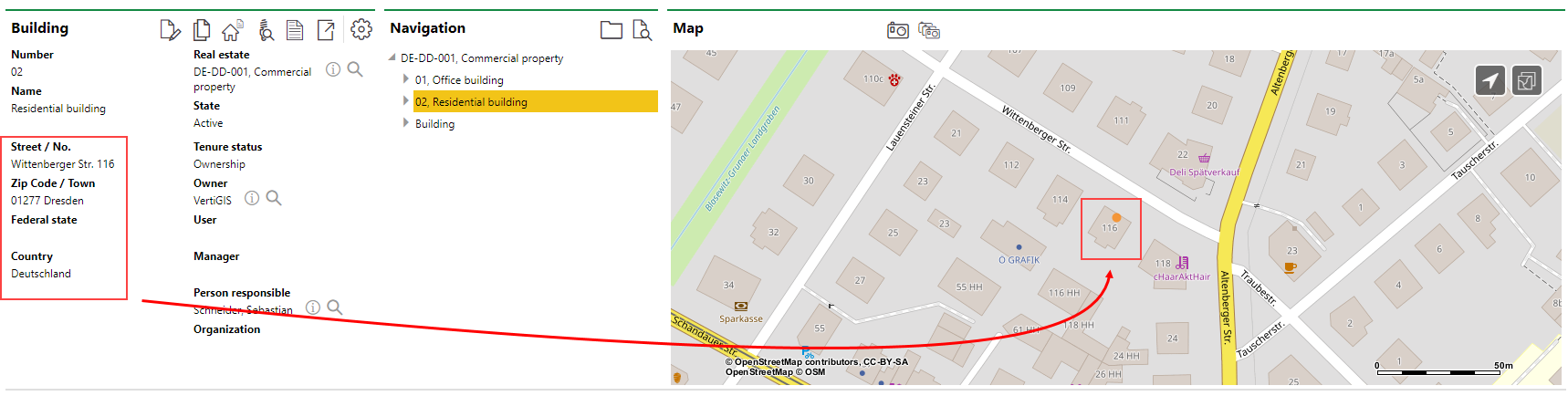
Building Location Shown Using the Open Street Map (OSM) in VertiGIS FM
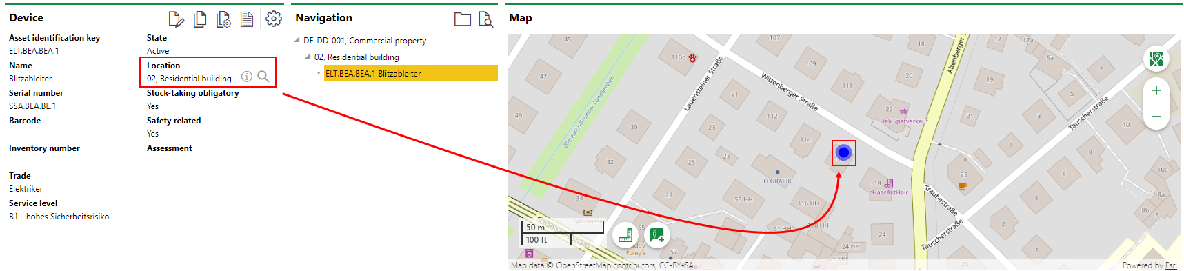
Device Location Shown Using the Location of the Building in which It's Located on the OSM
The OSM can activated or deactivated in the Maps section on the Administration > Settings > VertiGIS Studio page.
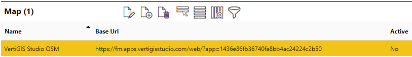
VertiGIS Studio OSM
To activate or deactivate the OSM, select it in the Maps section and click the Edit (![]() ) icon.
) icon.
The OSM becomes inactive when you integrate a web map from your ArcGIS portal with VertiGIS FM. You must delete all other maps from the Maps section on the Administration > Settings > VertiGIS Studio page if you want to use the OSM.
Viewer
The tools below are available when you view the OSM in VertiGIS FM.
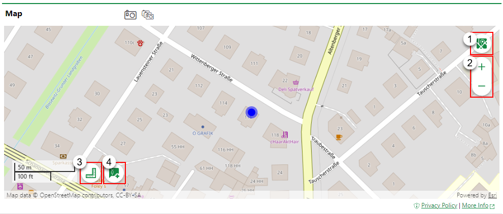
Open Street Map Tools
Legend |
Icon |
Function |
|---|---|---|
1 |
|
Select a basemap on which to view your assets: •Open Street Map •Topographic •Streets •Imagery |
2 |
|
Zoom in or out on the map. |
3 |
|
Calculate the distance between two or more points by clicking on the map. |
4 |
|
Find an asset's coordinates in Projected Coordinates (X/Y), Decimal Degrees (DD), Degrees Decimal Minutes (DDM), or Degrees Minutes Seconds (DMS). |